

California Fire - Fire Hazard Severity Zone Maps
California Fire: What's Changing, What It Means, and How to Stay Ahead
No. 2 of Blog Series - Fire Hazard Severity Zone Maps
If you've bought, sold, insured, or built a home in California recently, you may have heard the term Fire Hazard Severity Zone, or found out the hard way that your property is now sitting in one. In
last month’s blog, we introduced the bigger picture of how California's fire landscape has changed. This month, we're digging into what started it all: the
fire hazard maps themselves.
What exactly are Fire Hazard Severity Zones?
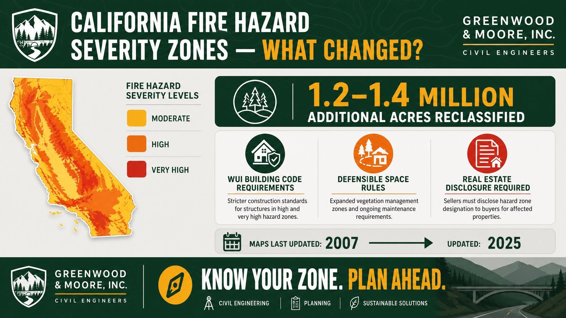
Fire Hazard Severity Zones, or FHSZs, are maps drawn by CAL FIRE and the Office of the State Fire Marshal (OSFM) that rate California’s land as Moderate, High, or Very High hazard. These ratings are based on things like vegetation, terrain, typical fire weather, ember travel, and fire history. This is not a prediction that your house will burn; they're a hazard rating, similar in spirit to a flood zone map. But these ratings trigger real, binding requirements once they’re adopted locally.
Why is this suddenly a big deal?
The maps just changed - in a big way - and for the first time in almost twenty years, CAL FIRE's prior statewide maps dated back to 2007. In 2025, OSFM rolled out a full update in four phases between February and March, and it reclassified roughly 1.2 to 1.4 million additional acres statewide into High or Very High zones. Local jurisdictions, including here in Alameda County, are now required to adopt these new maps by ordinance, and many properties that were never previously mapped, or that were mapped as Moderate, now show up as High or Very High.
What pushed the state to finally update these maps?
A few forces converged at once:
- Old maps, new science: Nearly 20 years of new data. The last statewide model was built in 2007, before the last two decades of drought, tree die-off, and fire behavior data existed.
- Recent history: Recent, catastrophic fires. The January 2025 Eaton and Palisades fires destroyed more than 18,000 structures and killed at least 30 people and were part of a broader run of increasingly severe fire seasons — 2024 alone saw over 8,000 fires and more than a million acres burned.
- State law forced the timeline Assembly Bill 211 (2022) set firm legal deadlines requiring local agencies to adopt the state's recommended zones by ordinance within 120 days, and it prohibits any local agency from downgrading the hazard level the state assigns, though a city or county can add areas or bump a rating up.
In short: the science caught up, the fires got worse, and the legislature closed the loophole that let some jurisdictions sit on outdated maps.
How does this play out in Alameda County?
OSFM released the updated Local Responsibility Area (LRA) maps for Alameda County in February 2025, and cities and the county are moving through their own ordinance adoption within that 120-day window. Locally it's meant real reshuffling - some areas gained High or Moderate status, while in places like San Leandro, some Very High designations were actually replaced by High and Moderate. Want to check a specific address? Alameda County Fire Department has an online hazard locator.
Is this “just another map,” or should we actually be paying attention?
Pay attention - this one has teeth. Unlike some planning overlays, an FHSZ designation isn't advisory. Once your local jurisdiction adopts the new map, landing in a High or Very High zone can trigger the following:
- Building code compliance: New construction and many remodels or additions must meet Wildland-Urban Interface (WUI) building code standards - the stricter materials, venting, and assembly requirements we covered in our WUI Code post.
- Defensible space requirements: Homes in Very High zones must maintain defensible space clearance around structures, with inspections enforced locally.
- Real estate disclosure: Sellers must disclose a property's FHSZ status to buyers, and in many jurisdictions provide a defensible space inspection (an AB 38 report) as part of the transaction.
- Emergency and planning use: Emergency planning, evacuation routing, and fire agency resource allocation all reference these zones.
Does this only affect new construction, or existing properties too?
Both, but differently:
- New: If you're building new or doing a significant remodel or addition, you'll need to meet current WUI code requirements the moment your project falls in an adopted High or Very High zone — there's no grandfathering into the old rules once you pull a permit.
- Existing: If you already own a home in a newly designated zone, your structure generally isn't required to be retrofitted to the new building code overnight. But you're not off the hook: defensible space requirements apply to existing properties immediately upon local adoption, and your disclosure obligations kick in the next time you sell.
Is the impact only financial?
No. Reclassification can mean added building costs, defensible space maintenance, and possible future retrofits — though the California Department of Insurance notes that FHSZ maps themselves don't directly set insurance rates or availability; insurers use their own risk models. Beyond dollars, there's real safety exposure to plan for, added stress for homeowners navigating new rules and disclosures, community-wide shifts in how cities plan growth and allocate fire resources, and a new factor in a property's marketability.
What this means for different roles
- Homeowners: Check your zone status — many parcels shifted without an obvious trigger.
- Developers and architects: Confirm zone status early in site selection and design; it determines which code path and cost basis a project falls under.
- Planners: Zone maps are now a standard layer in land use and entitlement review.
- Facility managers: A building that wasn't in a zone last year might be now — review your portfolio.
What to keep in mind
- Confirm your property's current, locally adopted FHSZ designation — not just the state's recommended map, since local agencies can increase (but not decrease) the hazard level.
- If you're planning new construction or a remodel, check your zone status before design begins, not after.
- Defensible space rules apply now, regardless of when your home was built.
- Selling soon? Budget time for the disclosure and inspection process.
How can G&M help?
This is exactly the kind of shifting landscape we navigate with clients every day. Whether you need help confirming your zone designation, understanding what it means for a project you're planning, or working through defensible space and disclosure requirements, we're your partner in this process. Reach out — we're an easy conversation away.
Since 1994, G&M’s goal is to “Make our Clients' Vision a Reality."